
Where are the fires in WA? Here's a map of the wildfires burning across the state
Multiple wildfires are burning across Washington state, producing smoky air quality for certain areas. Here’s a roundup of the latest progress made on the wildfires.
The familiar late-summer wildfire haze is starting to creep its way into areas around Puget Sound, and many are wondering if the smoke is coming from a nearby wildfire.
The growing wildfire threat isn’t just forcing some residents to evacuate, it’s also putting pressure on utility companies. With hotter, drier and windier conditions becoming the norm for Washington this time of year, utilities across the state are preparing for potential power shutoffs aimed at protecting communities.
Keep reading for a full list of current wildfires burning in Washington state.
Featured
With hotter, drier and windier conditions becoming the norm, utilities across Washington are preparing for potential power shutoffs.
Washington wildfire map
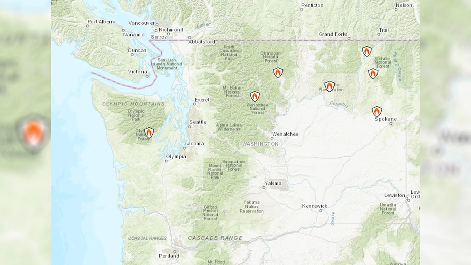
Washington Wildfire Map (Tuesday, Aug. 5, 2025). (InciWeb)
According to InciWeb, a U.S. government website that tracks wildfires and controlled burns across the country, seven wildfires are currently burning across Washington state: The Bear Gulch Fire, the Pomas Fire, the Stud Horse Fire, the Kinkaid Creek Complex Fire, the Hope Fire, the Castle Rock Fire and the Lake Spokane Fire.
Keep reading for a breakdown of each wildfire currently burning in Washington state.
The Bear Gulch Fire burning in WA’s Olympic National Forest
Level 3 “Go Now” evacuations remain in effect for parts of Mason County due to increased fire activity near Lake Cushman.
Map showing where the Bear Gulch Fire is burning in Washington state. (InciWeb)
The Bear Gulch Fire, which has been burning since July 6 in the Olympic National Forest near the Mt. Rose Trailhead, has burned nearly 5,000 acres and is 3% contained.
The Pomas Fire burning west of Lake Chelan, WA
The Pomas Fire in Okanogan Wenatchee National Forest has been burning since it started with a lightning strike on June 13.
Map showing where the Pomas Fire is burning in Washington state. (InciWeb)
The fire, which is burning about 10 miles west of Lake Chelan, has reached 3,465 acres and remains 0% contained.
Stud Horse Fire burning near Winthrop, WA
The Stud Horse Fire burning near Winthrop in Okanogan County is now 100% contained, prompting officials to lift all evacuation levels in the area.
Map showing where the Stud Horse Fire is burning in Washington state. (InciWeb)
The fire, which burned about 532 acres near Stud Horse Mountain – nearly two miles east of Winthrop – was ignited by a lightning strike last Thursday, officials said.
Kinkaid Creek Complex Fire burning in Okanogan County, WA
The Kinkaid Creek Complex Fire burning in Okanogan County has reached 313 acres and is 18%, according to Tuesday’s update.
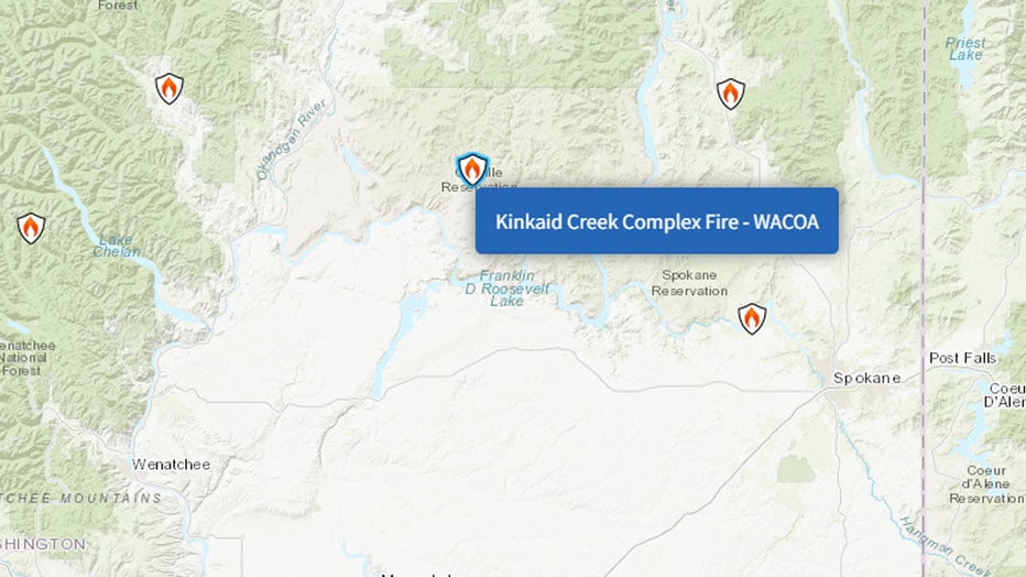
Map of Kinkaid Creek Complex Fire burning in Washington state. (InciWeb)
Officials say there are 216 firefighting personnel working on this fire that ignited from a lightning strike on July 31.
Hope Fire burning in northeast WA
The Hope Fire burning near Kettle Falls in northeast Washington has burned 8,117 acres and is 95% contained.
Map showing where the Hope Fire is burning in Washington state. (InciWeb)
139 firefighting personnel are working on this fire. The fire started on July 8, and crews are still investigating to determine what caused it.
Castle Rock Fire burning in northeast WA
The Castle Rock Fire, burning about six miles northeast of Colville, Washington, has burned 58 acres and is 20% contained.
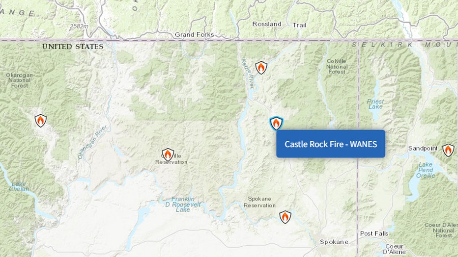
Map showing where the Castle Rock Fire is burning in Washington state. (InciWeb)
Officials say the fire was caused by a lightning strike on July 31.
Lake Spokane Fire burning northwest of Spokane, WA
The Lake Spokane Fire, which officials believe was human-caused, remains under investigation.
Map of Lake Spokane Fire in Washington state. (InciWeb)
The wildfire, burning 12 miles northwest of Spokane, ignited on July 19 and burned about 2,506 acres. 262 personnel were assigned to the fire, which is now 100% contained.
The Source: Information in this story came from InciWeb, a government website that tracks and monitors wildfires burning in the United States.
MORE NEWS FROM FOX 13 SEATTLE
Hundreds attend vigil for man shot, killed outside Seattle church
Voter guide: What to know about the 2025 WA primary election
Seattle Police Chief Shon Barnes addresses recent gun violence
Seattle ranks 89th for rental housing prices
To get the best local news, weather and sports in Seattle for free, sign up for the daily FOX Seattle Newsletter.
Download the free FOX LOCAL app for mobile in the Apple App Store or Google Play Store for live Seattle news, top stories, weather updates and more local and national news.