
What’s happening to our weather? Our Globe meteorologist and other experts answer more of your questions

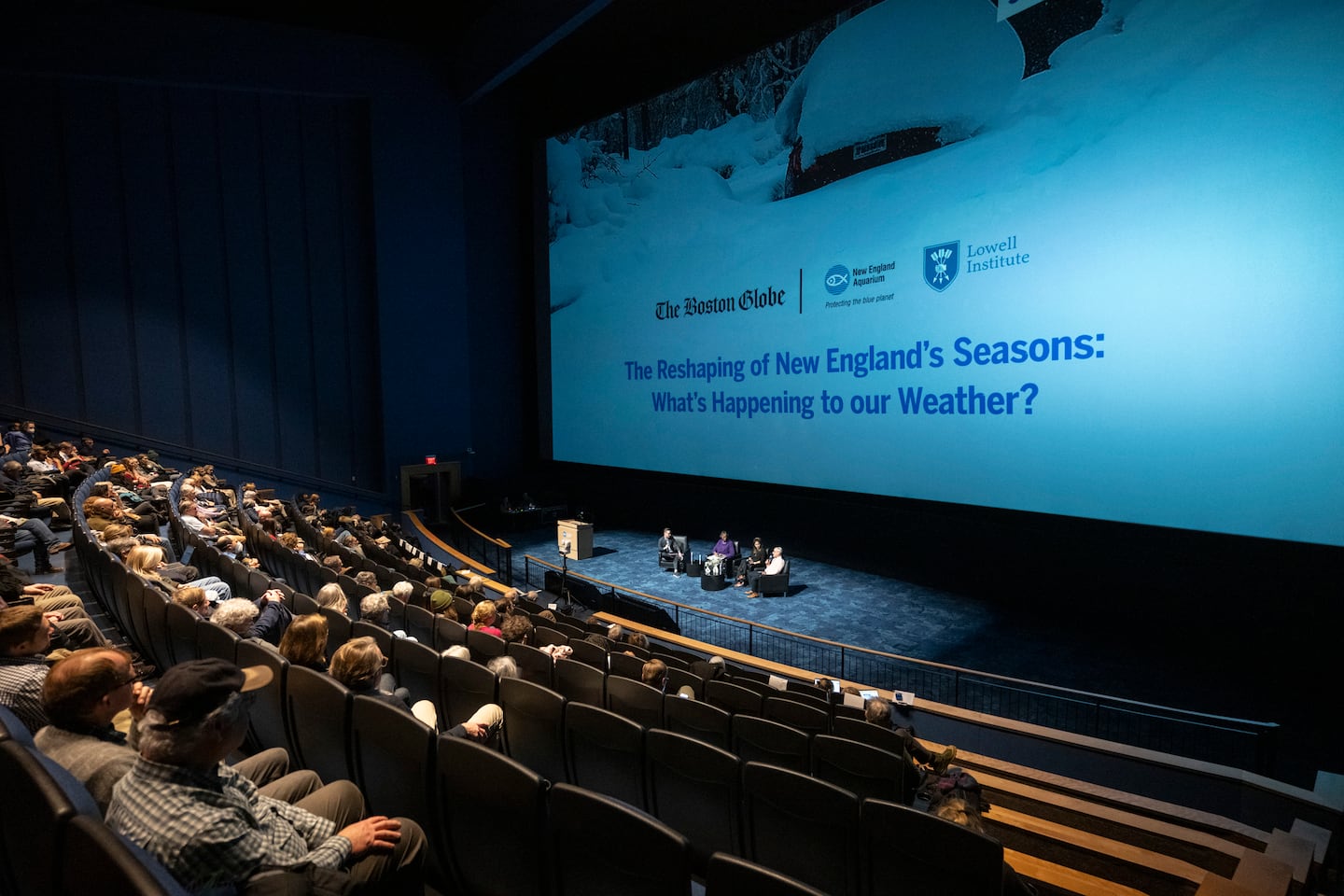
In fact, we received an overwhelming number of audience questions that we simply ran out of time, and couldn’t get to all of them, so we thought we’d tackle them here.

Q: In addition to stronger storms, are we also getting more vigorous clearing gales after the storms, especially in winter?
A: Yes, we are. We’ve seen almost every storm that tracked through New England into the Gulf of Maine strengthen as it hits warmer water, holding available storm fuel (moisture).
This increases the pressure gradient and subsequent wind speed across coastal New England. We’ve seen Boston’s Logan Airport have the windiest year (2025) since becoming the official reporting site in the 1930s, with the average wind gust exceeding 30 mph for the first time on record.
— Ken
Q: With how much certainty can we say that Massachusetts’ changing/unpredictable weather patterns are due to climate change? How can we explain it in a way that’s easy to understand for folks who are still denying the existence of anthropogenic climate change?
A: We have to keep in mind that the weather is short-term and the climate is a long-term pattern. What climate change does is shift the odds to more extreme weather events. Weather events such as heatwaves, flooding, rainfall, or unusual cold waves become more likely and more intense.
One way for me to share the existence of climate change impacting our weather is impact. How many billion-dollar disasters have happened across the country in the last 20 years versus the previous 20? And yes, inflation is accounted for. A total of 17 of the top 20 billion-dollar disasters all occurred in the last 20 years.
Another way to think about climate change is like a retail store. Climate is the background music while customers (weather) shop. The music sets the stage. If it’s too loud or fast, then customers will react and become restless in the store. Climate change increases the chances of extreme weather events.
— Ken
Q: How do changing climate patterns affect the risks to local food production?
A: It all comes down to growing conditions for our local crops. With changing seasons, growing and harvest seasons become less predictable. And of course, more extreme weather events like flooding rains or extreme drought can really impact the way our crops thrive or wilt.
Local farmers have to spend more to adapt and prepare for extreme weather, and unfortunately, most of the cost will be passed on to the consumer.
— Ken
Q: I thought that with climate change, New England was expected to get more precipitation. There have been many periods in the last few years with below-average precipitation (drought). Is this just cyclical, and the expectation is still for more rain? Or does climate change bring these fluctuations?
A: I would say that this is more influenced by climate change rather than a cyclical weather pattern. Climate change increases the amount of extremes and volatility in our local, typical weather patterns.
The last two summers and falls saw extensive drought plague much of New England. But both of those drought spells came after a spring season that produced more precipitation than average across New England.
This winter, we have seen very cold temperatures with an increase in storm frequency and intensity. As we near spring, and our storm pattern continues, we may be in for another flooding spring.
— Ken
Q: What do changes in our climate mean for the northward progression of some invasive species like the spotted lanternfly?
A: I’m not an entomologist, but increasing warmth and humidity during all four seasons has led to the increase of invasive species like the spotted lanternfly in our region.
Winter used to be the failsafe way to end any species that were invasive during the other three seasons, but a generally warmer winter has allowed for insects like ticks to survive the winter months and multiply even more throughout spring.
I suspect our current winter will lower some of the insect population numbers this spring, but generally, we’re seeing more and more ticks and spotted lanternflies across the region.
— Ken
Q: How have our changing weather patterns affected wildlife (migration, breeding, food finding)?
A: Here in New England, climate change is throwing species for a loop, carrying invasive species, like ticks, farther into the region, and altering the habits of species that have long called the area home.
Take the groundhog. In New England, groundhogs typically hibernate from October or November until the end of February. But in recent years, which have had unusually warm temperatures and a lack of consistent snow, it’s become more common for people to see groundhogs waking up early. That’s true for several species of bats, too.
The trouble is, climate change isn’t moving the thermometer consistently in one direction — it’s introducing a lot more variability into our system, too. So when species wake up early due to warmer weather, they can then run into trouble when the temperature drops back down.
Out in the Gulf of Maine, which is warming faster than almost any other body of water on the planet, species are on the move, following cooler water steadily northward. A decade ago, Maine shrimp were on every menu. Now, they are gone after an influx of longfin squid moved into the region along with warmer water, and led to the collapse of the fishery.
It’s a similar story for wild blue mussels. Once prolific in New England waters, a 2017 study found that as the gulf’s waters have warmed in the past 40 years, the population of wild blue mussels has dropped 60 percent along the coast.
What’s happening here tracks with what scientists are watching around the world. As the climate warms, species are following their preferred climate toward the poles or higher in altitude.
— Sabrina
Q: What phase of the water cycle is being diminished? How does it impact location and local communities near rivers and watersheds? What steps do people and communities need to take to ensure that fresh, clean water is available to all?
A: I would say the most diminished phase of the water cycle across New England is the release of water, from snowpack from winter to spring, and a lower amount of natural storage. I know this is the coldest winter since 2015, but nine of the past 10 years have seen warmer winters with less snow and more rain, so water runs off more quickly instead of melting gradually in the spring. This leads to excessive river flows and lowering water tables heading into summer and fall.
Local communities experience drought-like conditions with this rapid release of water and streamflow. The result? Reduced drinking water supply and lower rivers that can impact fish and other local ecosystems.
I would purchase a rain barrel immediately so you can collect rainwater from your gutters and distribute it as you see fit. On a larger scale, towns and cities can upgrade aging water infrastructure through stormwater management.
— Ken
Q: How come it seems to get warmer at night now instead of cooler?
A: A warmer atmosphere holds more water vapor and moisture. This means more humidity and more clouds across the region. The combination of increased humidity and cloud cover slows the rate of nighttime cooling from daytime heating. This added atmospheric moisture acts as a blanket and keeps the heat trapped near the surface at night, elevating temperatures.
There has been a steady increase in nighttime lows of over 70 degrees in Boston, Worcester, Springfield, and even Northern New England cities over the past 10 summers.
— Ken
Q: As seen in Canada over the past few summers, do we expect to see an increase in wildfires across New England?
A: I really think we do. We’re seeing more heat during the summer months and spilling into fall. This increases our chances of seeing the ripe conditions for wildfires — heat, low humidity, and wind. I think the chance for wildfires increases gradually, but we’re entering a new phase where wildfires may become more common than rare for our region.
— Ken
Q: Could you speak to how the ocean influences the Boston area climate specifically? Does the ocean effect exacerbate or mute the changes discussed during the event?
A: The ocean plays a major role in the Boston area’s climate and weather. The ocean adds moisture to fuel storms year-round, while sea-surface temperatures can shape the precipitation type during the winter months.
Water heats and cools more slowly than land. The ocean keeps Boston cooler during the spring but warmer during the fall and winter. This is why Boston tends to warm up later during the spring and then cool down later during the fall.
The neighboring ocean can influence wind patterns, storm intensity, and humidity levels, which can alter how Boston’s weather unfolds. Boston is seeing more humid air, stronger coastal storms, rising sea levels, and less overnight cooling, making heat waves last longer and increasing flood risk along the coast and nearby rivers. So, in short, the ocean exacerbates the evolving seasons and weather events New England is experiencing.
— Ken
Q: New England typically doesn’t have many natural disasters other than blizzards. Will we expect that to change? What does this mean for winter sports like skiing in the future?
A: Yes. Excessive rainfall over varying terrain has been the leading weather event that has wreaked havoc in areas like Vermont’s Northeast Kingdom and northern Worcester County in the last couple of years. Except for this great ski year, our winters have struggled to produce snow, especially for ski and snowsport resorts across the region. A few ski areas have closed their lifts for good over the last couple of years.
Unfortunately, I see winter sports struggling more years than not as we move forward with our general trend of warming winters. That is why so many people are making a conscious effort to enjoy the mountains and iced-over ponds this winter.
— Ken
Q: Could someone please explain in more detail why climate change is disrupting the polar vortex?
A: In our research, we have demonstrated that polar vortex stretching events have accelerated in the era of accelerated Arctic change. Climate change in general, but Arctic change in particular, is forcing these events. The schematic below provides a generalized timeline of the significant atmospheric features beginning with Ural/Barents-Kara Seas high-pressure ridging, followed by North Pacific high-pressure ridging, and ending with North American and East Asian low-pressure troughing, cold and snow. It is argued that warming in the Barents-Kara and Chukchi-Bering seas favors ridging/high pressure in these respective regions in the troposphere. Autumn and winter Siberian snowfall has also been increasing, indicating low-pressure troughing over East Asia.
This pattern of ridging in the Urals/Barents-Kara Seas region and troughing in East Asia strongly projects onto the tropospheric pattern, encouraging the polar vortex stretching that often delivers extreme cold to Canada and the US. This theory is supported by a global climate model showing increased Eurasian snow cover and decreased Barents-Kara sea ice, where the atmospheric response is an increase in SPV stretching events, with troughing and colder temperatures across Asia and North America one to two months following the introduction of Arctic forcing.
Therefore, Arctic change is likely contributing to the increasing frequency of polar vortex stretching events. This fall and winter, sea ice was record low in the Barents-Kara Seas and snowfall has been heavy in Siberia this fall and winter. This, in my opinion, has influenced the polar vortex disruptions we saw at the end of January into early February.
— Judah

Q: As a climate educator, I see comments during cold weather that ridicule “warming.” Can you talk about the WACC dynamic? People don’t understand the cold snaps.
A: WACC stands for the Warm Arctic-Cold Continents pattern. This describes the Arctic becoming unseasonably warm while parts of North America, Europe, and/or Asia turn unusually cold at the same time. It’s a see-saw effect between cold and warm air masses; if one is present, you can bet the other is, as well.
This happens when the jet stream, a band of fast-moving air that acts as a fence keeping cold air locked to the north and warmer air to the south, weakens and becomes more wavy. When the jet stream looks like a wet spaghetti noodle over the Northern Hemisphere, cold Arctic air can spill south over the Lower 48 at times, while warmer air drifts north toward the Arctic.
WACC helps explain why we can still get severe winter cold spells even as the planet overall is warming, and it’s often discussed in climate science, especially in relation to rapid Arctic warming, or, as many meteorologists have noted in recent years, sudden stratospheric warming.
— Ken
Q: The science of climate communication shows people engage with climate solutions that resonate with identities, values and hope. Where can we learn more in Boston?
A: I’m a big fan of the Stone Living Lab and the climate programs through Boston Harbor Now. I would do a quick Google search, and you can see plenty of climate change advocacy and action programs in our area.
I also am a big fan of the Keep Massachusetts Beautiful initiative, mostly geared toward environmental efforts, more so than climate change, but there are strong communities within this network.
— Ken
Q: Will the Gulf Stream be affected by glaciers melting? What if it stops?
A: This is a very interesting question. I actually think that the Gulf Stream won’t be affected dramatically by glacier melting, because the ocean temperatures closer to the equator are more like bathwater temperature versus the lukewarm ocean temps across the Northern Atlantic.
Even though the atmosphere is unlocking the more dense ice water from glaciers, I feel there is simply too much warm water than colder water to be too impactful. The Gulf Stream is driven by our wind patterns, and our wind patterns are growing stronger, as well.
If the Gulf Stream did come to a stop, the result would be catastrophic — sharp changes in our day-to-day weather with complete flips in our seasonal patterns. It would be a new way of the world across the Eastern U.S. and much beyond.
— Ken
Q: What immediate and longer-term strategies for coping with weather extremes can northern US residents undertake?
A: I’ll put it this way: Extreme weather is less about one-off events and more about volatility and intensity. Sure, immediate strategies are to have supplies in the event of power and heat/cooling losses. But the goal is to make everyday life more adaptable, so extremes feel more manageable instead of overwhelming.
So, for longer-term strategies, prepare your home in bits and chunks with insulation upgrades like windows. Or perhaps exploring proper backup battery options for power when it goes out.
— Ken
Q: With the recent heat waves during back-to-back years now in June and July, and the hazy wildfires, is this expected to continue or can this be avoided long term?
A: I actually think that we’re going to see heat waves become more problematic for summers to come. And the same goes for wildfire smoke drifting over New England. The average temperature across the United States has been above the climatological average each year since 1996. That’s about 30 years. And the last nine years have produced the top five warmest years on record for the country.
Our weather patterns are just promoting more heat events across the country, and New England is sitting downstream from the general weather pattern. Any wildfires that end up sparking will likely spew some smoke our way.
— Ken
Q: The pine barrens of Southeastern Mass. and Cape Cod are a highly flammable plant community. Do the models indicate an increased risk of catastrophic wildfire in this area?
A: The pine barrens are quite combustible, that’s for sure. I do think that Massachusetts, and really all of New England, will see increased wildfire risk as long as we’re seeing drought conditions.
We need little to no rainfall paired with low humidity and windy conditions to really bring the words “catastrophic wildfire” into the conversation. We’ve seen rainy springs with dry summers for the past two years. And some of the longer-term models indicate that we may be in for more drought this summer. I don’t think we’ll get to catastrophic levels, but I can see more brushfires occurring August through October.
— Ken
Q: What is the main driver of the climate change happening here in Boston?
A: For Boston, it’s the combination of energy emissions from our buildings and vehicles. But even more so, Boston sits geographically at the warmer ocean and the jet stream storm track. We’re in a breeding ground for storms, and climate change has increased the chances of extremely volatile weather across Boston and New England — a culmination of the world’s human-induced emissions that has warmed our seas and air.
— Ken
Q: It is often thought that climate change skepticism is a result of misinformation. How does one explain the striking number of meteorologists who are skeptics?
A: I think that for those meteorologists who are considered climate skeptics, they are not denying that our climate is changing.
Instead, in my opinion, it seems that the skepticism lies with what our future impacts will look like. Like, how fast do climate change-influenced weather events occur?
We have to remember, too, that meteorologists differ from climatologists as we focus on short-term forecasting, which is hard enough to get right. Climatologists lean on the longer-term climate models, and there may be more limits within the models.
It all comes down to how we talk to each other about climate change and hold respect in exploring what extreme weather may be coming down the pike.
— Ken
Q: Can you talk about how AI can be used in determining weather patterns and what the future of AI will be in better climate prediction? How can we use AI well?
A: AI does a great job of crunching immense datasets in a fraction of the time that the traditional weather models take. But there is still a lot of caution because the accuracy isn’t much better than traditional weather models.
In terms of AI and climatology, climate change will keep AI on its toes, making the best scenario for AI models to work alongside physical models, because meteorologists and climatologists understand climate change more than the AI models do, and make the necessary adjustments for a better, more accurate forecast.
If AI is used well, it can speed up simulations and improve forecasting. But if used poorly, it can over-rely on past, old data and not take into account regional differences. AI will always need human support to be used properly.
— Ken
Climate change and extreme weather are very important, yet sensitive, topics for many. Extreme weather events keep increasing across New England, the country, and the globe. The more questions we ask, the more we listen to scientists’ and others’ input, the more we can come together and better adapt to our changing seasons.
Sign up here for our daily Globe Weather Forecast that will arrive straight into your inbox bright and early each weekday morning.
Ken Mahan can be reached at ken.mahan@globe.com. Follow him on Instagram @kenmahantheweatherman.