
Climate change is reshaping Arctic rivers in different ways
Water in the Arctic may seem quiet, but it affects the whole planet. Rivers carry melted snow into the ocean, shaping ice, currents, and global temperatures.
Something has started to change. Scientists tracking these waters now see patterns that do not follow a simple trend.
Some regions are getting wetter, while others are drying out. The old idea that a warming Arctic would simply mean more water everywhere is starting to fall apart.
Watching Arctic rivers from space
For years, researchers depended on measuring stations planted along riverbanks. These gauges recorded how much water flowed through major rivers.
But the Arctic is vast and difficult to reach. Keeping those stations running costs time and money, and many have been shut down.
So scientists looked up. Satellites now circle Earth, quietly collecting data about water, snow, soil, and rainfall.
By combining these streams of information, researchers have built a new way to track how water moves across the Arctic without setting foot on the ground.
This effort comes from a team working through the European Space Agency’s STREAM-NEXT project. The group, led by researchers from Italy’s National Research Council and the University of Perugia, created a model that uses only satellite data to estimate river flow and runoff across the region from 2003 to 2022.
Tracking Arctic water flow
The new system pulls together several types of satellite data. It looks at changes in Earth’s gravity to estimate water storage, tracks soil moisture, maps snow cover, and measures rainfall. All of this feeds into a model designed specifically for Arctic conditions.
The result is a daily record of how water moves through rivers and across land. It covers even remote areas where no instruments exist.
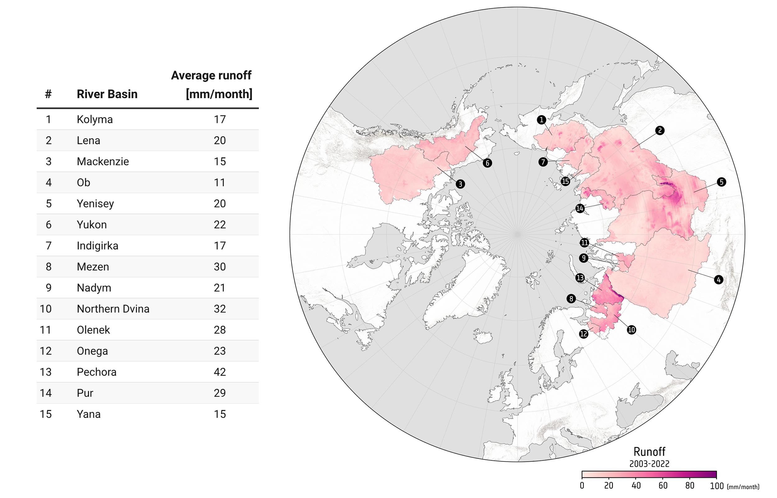
Using this approach, researchers estimate that Arctic rivers send about 4,760 cubic kilometers (1,142 cubic miles) of freshwater into the ocean each year.
Most of that water, roughly 80 percent, comes from rivers in Eurasia, especially across Siberia. That flow plays a major role in shaping the Arctic Ocean’s behavior.
Arctic water tells many stories
The data shows something more complex than expected. Water patterns across the Arctic do not move in a single direction. Instead, they form a mix of changes that vary from place to place.
Francesco Leopardi from the University of Perugia, lead author of the study, explained it this way: “While the expected response of the pan-Arctic region to climate change would suggest an overall increase in runoff, satellite-based estimates reveal a more heterogeneous picture.”
“Across the Arctic, freshwater flow is not changing uniformly; instead, the region is exhibiting a patchwork of change. Some areas are becoming wetter, whereas others – such as the Mackenzie River basin – are experiencing declining runoff.”
Overall, these findings challenge the notion of a uniformly ‘wetter’ Arctic, highlighting instead a system undergoing uneven and regionally contrasting change.
Different regions, different outcomes
Several forces are shaping these uneven patterns. Air temperatures are rising, but not at the same rate everywhere.
Rainfall is shifting. Snow melts earlier in some places. Permafrost, once solid ground, is thawing and changing how water flows.
Each region responds in its own way. A basin with heavy snow may see stronger spring floods. Another area with less snow and more evaporation may lose water overall. These differences create a patchwork across the Arctic rather than a single trend.
This matters because freshwater flow influences ocean circulation. It also affects ecosystems, from fish habitats to migratory birds. Even people who live in northern communities depend on these water systems for daily life.
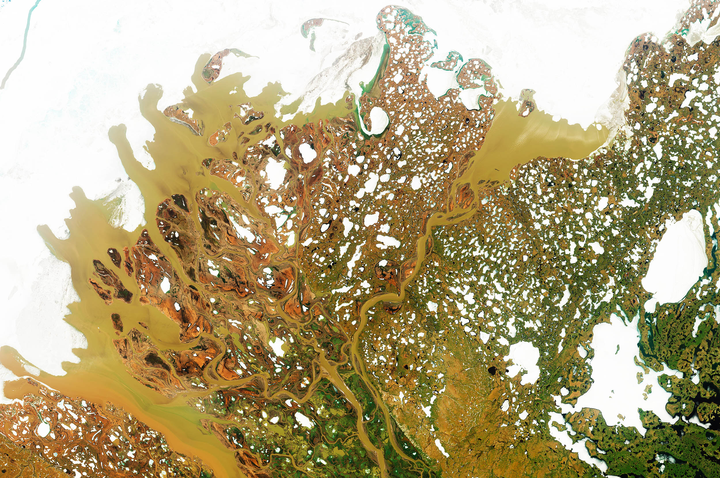
Scientists are starting to rely more on satellites to study Earth. In remote places like the Arctic, they are often the only way to keep track of changes over time.
New satellite missions will make this even better. One upcoming mission will measure tiny changes in Earth’s gravity to figure out where water and ice are and how they move.
It might sound odd, but it works. When water shifts, it slightly changes the Earth’s weight. Satellites can pick up those small changes and use them to map where the water is going.
These measurements are now becoming essential for understanding how a changing Arctic shapes the rest of the planet.
—–
Like what you read? Subscribe to our newsletter for engaging articles, exclusive content, and the latest updates.
Check us out on EarthSnap, a free app brought to you by Eric Ralls and Earth.com.
—–